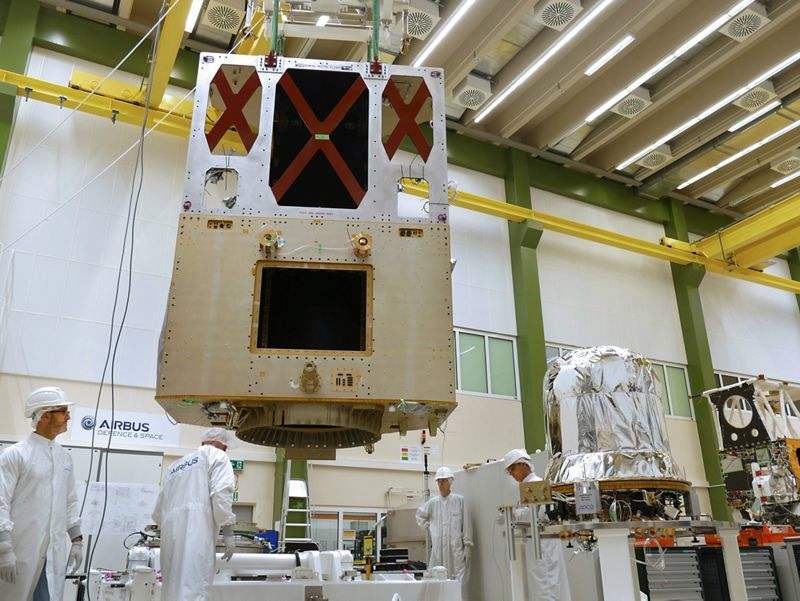
The integration of Sentinel-6A has reached a new milestone following the mating of the propulsion module with the main structure of the satellite at Airbus.
The integration of Sentinel-6A — the first of a pair of satellites to carry out high-precision measurements of ocean topography from 2020 onwards — has reached a new milestone following the mating of the propulsion module with the main structure of the satellite at Airbus' Frierichshafen facility in Germany.
Two Sentinel-6 satellites (6A and 6B) for the European Copernicus programme for environment and security, headed by the European Commission and ESA, are currently being developed under Airbus’ industrial leadership, under a €177m contract awarded in May 2015.
The mission is an international partnership between Europe and the U.S. It builds on heritage from the Jason series of ocean topography satellites — hence its alternative designation as Jason Continuity of Service (Jason CS) — and from ESA’s CryoSat mission.
Thales Alenia Space France is supplying the main instrument, a radar altimeter, whose predecessor is already being used on CryoSat-2, Jason-3 and Sentinel-3. Further instruments are being developed by NASA/JPL. The American National Oceanic and Atmospheric Administration (NOAA) is also a partner of Sentinel-6/Jason-CS.
Operations for the missions will be overseen and managed by Eumetsat in Darmstadt, Germany.
The satellite will measure its distance to the ocean surface with an accuracy of a few centimetres and, over a mission lasting up to seven years, use this data to map it, repeating the cycle every 10 days. It will document changes in sea-surface height, record and analyse variations in sea levels and observe ocean currents.