Coming in the wake of a significant increase in reports of near misses between drones and commercial aircraft in the UK during the past year, ATC service provider NATS is promoting a new app for drone pilots. The app has been developed in partnership with Altitude Angel, a UK-based company working on innovative drone traffic management solutions.
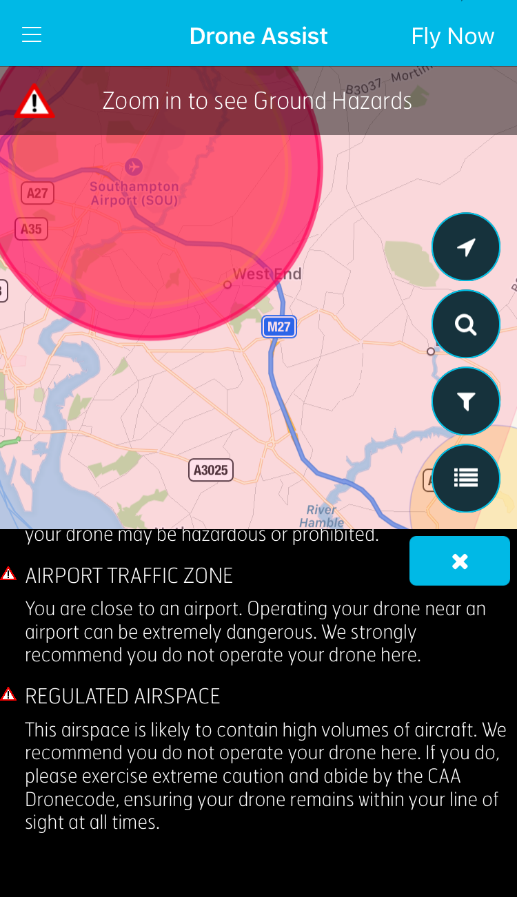
Called Drone Assist, the app has been available for free on Android and iOS since 3rd December. It presents drone pilots with an interactive map of areas of airspace used by commercial air traffic. It will also contain a ‘Fly Now’ feature that will share the user’s drone flight location with other app users, and the wider drone community, helping to reduce the risk of a drone-related incident in the UK’s airspace.
The app also includes the location of ground-based hazards that might pose a safety or privacy risk, such as power lines, schools or sports venues.
The UK Airprox Board, which investigates reports of aircraft near misses, has so far reported on approximately 50 drone incidents this year, up from 11 during 2015.
In a recent study by the CAA, 90% of people agreed that adherence to the CAAs Dronecode is important but only 40% of drone owners were aware of it. The app also offers access to a new website launched by NATS and the CAA called dronesafe.uk. The site provides further information on the rules around drone flying in the UK, including the CAAs Drone Code and information on CAA-approved training courses.