Aviation stakeholders can now pre-register for the free, global Aircraft Locating and Emergency Response Tracking (ALERT) service, operated by the Irish Aviation Authority (IAA)
Aireon and the Irish Aviation Authority (IAA) have announced that Air Navigation Service Providers (ANSPs), Aircraft Operators, Regulators and Search and Rescue Organizations can now pre-register for their free, global Aircraft Locating and Emergency Response Tracking (ALERT) service.
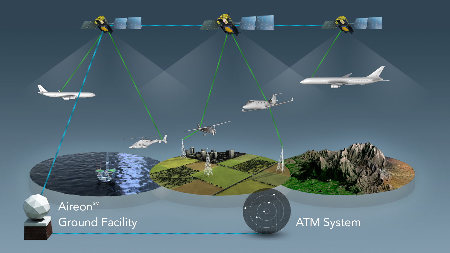
The Aireon ALERT service will provide the last known position of an Automatic Dependent Surveillance-Broadcast (ADS-B)-equipped aircraft that is in an apparent distress state or experiencing a loss in communication.
The Aireon system is hosted on the Iridium NEXT satellite constellation, which will consist of 66 low-earth orbit cross-linked satellites. A total of 81 Iridium NEXT satellites are being built, all of which will have the Aireon payload onboard.
Currently, 65 satellites are in orbit following the successful launch of a seventh batch on a SpaceX Falcon 9 on 25th July. A total of 75 satellites are planned to be deployed with nine serving as on-orbit spares and the remaining six as ground spares.
The Aireon ALERT system is expected to be operational in the first quarter of 2019 and will be operated out of the IAA North Atlantic Communications Centre in Ballygirreen, County Clare, Ireland.
Worldwide coverage
ANSPs, Aircraft Operators, Regulators and Search and Rescue organizations will have access, on request, to exact position data for an aircraft in distress over the oceans, remote areas and anywhere else they may need aircraft position information in an emergency.
Users of the service do not need to be customers of either Aireon or the IAA to use the service; they simply need to be registered. Once a stakeholder has registered and been approved for Aireon ALERT, should an emergency arise, it can contact the 24/7/365 operations facility to obtain the last known position of its aircraft.
This will include a map of the last 15 minutes of flight, with one plot per minute and a 4-dimensional report including altitude, latitude, longitude and time information. Based on the situation, additional tracking information may also be provided. Aireon ALERT will be provided as a public service, free of charge to registered stakeholders.
Aireon has teamed with FlightAware to create GlobalBeacon, which combines FlightAware’s data processing platform and web interface with Aireon’s space-based ADS-B data, for a cost-effective solution to help meet the ICAO Global Aeronautical Distress Safety System (GADSS) standards.
In addition to GlobalBeacon, FlightAware is delivering the data through services that are already commonly used by airlines and industry leading service providers such as SITAONAIR.
Airbus recently announced a strategic partnership with Aireon as part of its AirSense analystics solution.